The 2019-2020 season began with storms in the second week of October. The month closed with several more storms continuing on and off through the end of the month. Observers reported “excellent for October ” conditions. SNOTEL stations in the Northern and Central Mountains reported far more than typical amounts of precipitation, but “more than normal” in October still translated to rather thin snow cover with just a couple inches of snow-water equivalent on the ground. The CAIC recorded six small natural avalanches in the Northern and Central Mountains. A foot or less of snow fell in the Southern Mountains, enough to offer a glimpse of winter but not much snowy recreational opportunities.

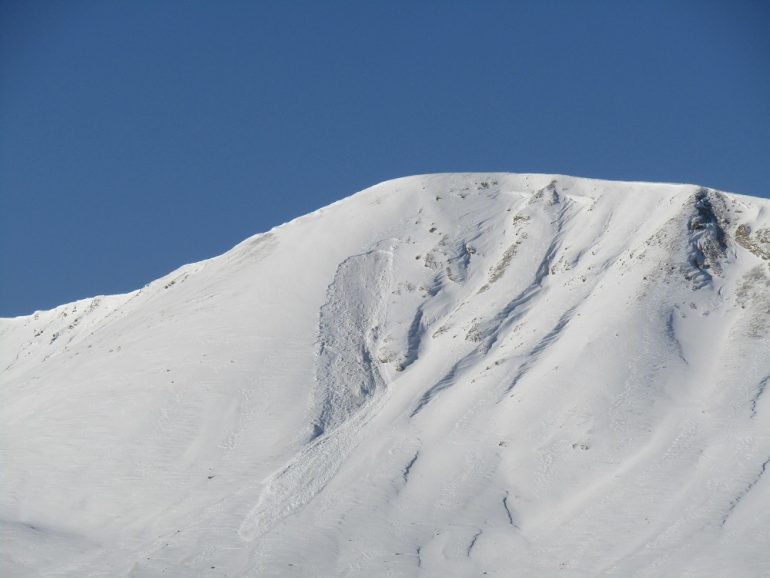
First reported natural avalanche of the 2019-20 season. This soft slab avalanche released on a northeast-facing slope on Independence Pass around October 24 after receiving around a foot of snow in the previous week.
November began with almost three weeks of dry, mild weather. The snow that lasted through the dry spell on high-elevation north and east-facing slopes faceted into well developed depth hoar. This became the poor foundation upon which we would build the rest of the season’s snowpack. Thin crusts formed on sunny slopes that did not melt back to bare ground, and widespread surface hoar formed on the snowpack surface. Snowpack characteristics were similar statewide, other than more melting in the San Juan Mountains, and some isolated drifts of dense snow in addition to the depth hoar and thin crusts in the Northern Mountains.
Snowfall starting November 20 brought an end to the dry weather, and a corresponding uptick in avalanche activity across the state. Most avalanches ran on higher-elevation north and east-facing slopes and most broke into the depth hoar. With a shallow snowpack most avalanches were small, but the pattern was a sign of things to come. A series of storms would close out the month starting just prior to Thanksgiving. The snowpack failed this second test and we saw another avalanche cycle. We also started to see some variations across the regions.

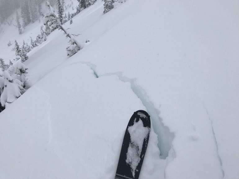
This is an example of a shooting crack from the Aspen zone on November 22, 2019. Obvious signs of instability like these were widespread around the state when snowfall returned around November 20, ending our November dry spell.
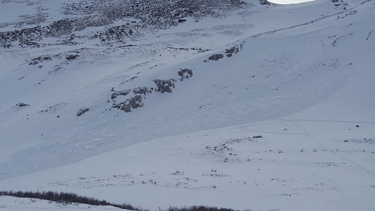
In the Southern Mountains observers found shooting cracks, collapses, and a natural avalanche cycle that occurred the day after Thanksgiving. That prompted the first Avalanche Warning of the season on November 29. On November 30, two snowshoers triggered and were caught in an avalanche east of Red Mountain Pass.

This avalanche was remotely triggered from flat terrain on Red Mountain Pass on the last day of November. Avalanches like these gave us a good indication of how December would unfold when we got more loading events.
Snowfall from storms around Thanksgiving Day overloaded portions of the Central Mountains. The result was a cycle of small to large natural and human-triggered avalanches in the Gunnison and Aspen zones. The month ended with Considerable (Level 3 of 5) danger ratings and backcountry forecasts discussing the potential for people to trigger large avalanches near and above treeline on north through east aspects, especially around terrain features with wind-drifted snow.
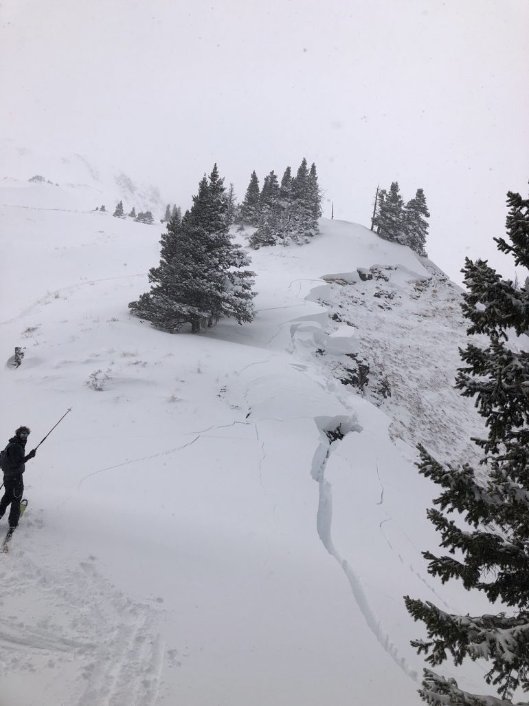
In the Northern Mountains, a strong upslope storm developed just before Thanksgiving Day. A backcountry skier was caught and carried in a small avalanche while skinning uphill in Jones Pass on November 22. A backcountry skier was buried with just an arm above the snow near Searle Pass on November 28. A swift companion rescue prevented a tragic outcome. As snow continued to accumulate, avalanche size increased with a few large avalanches reported on November 29 and 30.

This small avalanche buried a person with only one arm sticking out of the snow on Thanksgiving Day. The other two people in the group quickly rescued the victim. The storms around Thanksgiving Day caused avalanche danger to rise and a corresponding increase in avalanche activity.
We ended the month on the way to better coverage, but with poor snowpack structure and weak layers ranging from depth hoar, to crust-facet combinations, to buried surface hoar. We were primed for more avalanche activity as soon as we got our next loading event.
