by Brian Lazar
Our first reported natural avalanche of the 2020-2021 season was associated with a healthy early September snow storm. After this single, small loose-snow avalanche in the Sangre de Cristo Range, the snow that fell in September almost completely melted away. A small storm in the second week of October added a little more to the snow cover, but our seasonal snowpack didn’t really begin to develop until we received a storm on October 24 to 26. This storm deposited 6 to 10 inches of snow across most mountain areas, with a little more in a few localized areas. Post-storm winds built stiffer slabs along ridgelines, and we closed out the month of October with the first report of a skier-triggered avalanche for the season near Breckenridge.

First reported human-triggered avalanche of the 2020-2021 season on Boreas Pass, near Breckenridge. October 31.
November had three storm events, and each produced an uptick in avalanche activity. The CAIC recorded 141 avalanches during the month, though only four of them were large enough to bury a person. Despite few areas with enough coverage for on-snow travel, seven people were caught in avalanches.
The first week of the month was dry and sunny. This melted the October snowfall on all but northerly-facing slopes at higher elevations. The snow that survived grew weak and faceted before the first storm arrived on November 7.
The first storm dropped 6 to 8 inches of dense snow across the Northern Mountains. This wasn’t quite enough to obscure the ground cover on most slopes, and we didn’t record any avalanche activity across the Northern Mountains region.
The Central Mountains picked up 6 to 15 inches of snow, favoring areas near Independence and Schofield Passes. With Highway 82 over Independence Pass still open, people had relatively easy access to high-elevation slopes. Three people triggered and were caught in small avalanches in Mountain Boy Basin over a two-day period. We recorded several small natural and rider-triggered slab avalanches across the rest of the Central Mountains.
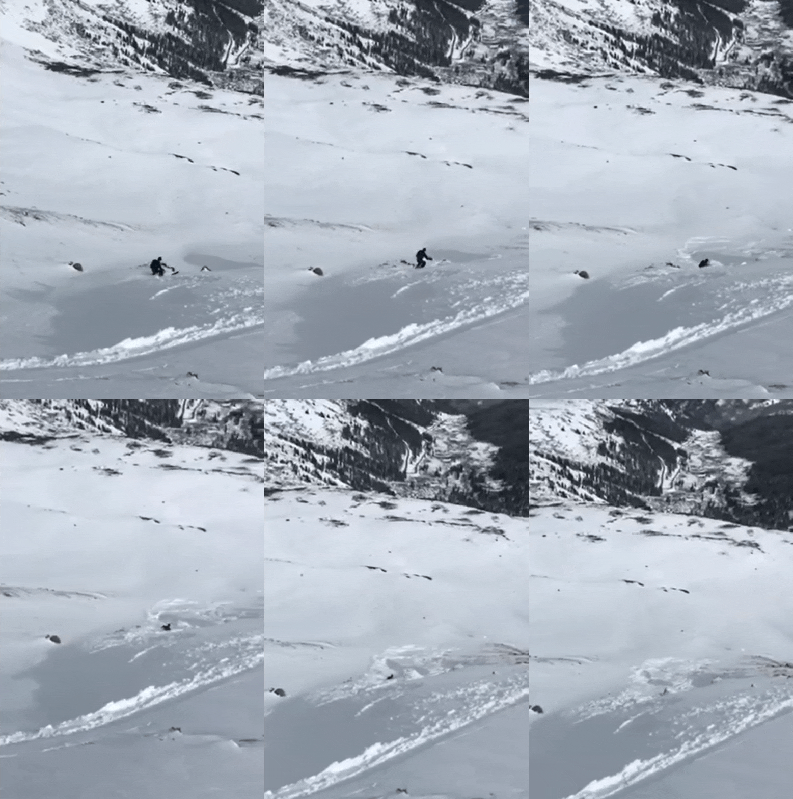
One of the first avalanche incidents of the season on a high east-facing slope in Mountain Boy Basin near Independence Pass. November 9, 2020.
The Southern Mountains were the clear winner from this first November storm, picking up 1 to 3 feet of snow between November 7 and 9. Coal Bank and Wolf Creek Passes received 4 to 5 inches of snow water equivalent (SWE). This storm helped to build the snowpack in the Southern Mountains faster than in the rest of the state, and this difference still remained significant through the end of the month. Although triggered avalanches were limited, we did record several skier-triggered avalanches near Red Mountain Pass and around Silverton.
After a four-day dry spell, the second storm of the month arrived November 13. This was a fast-moving storm that favored the Northern Mountains and was more notable for ferocious winds rather than ample precipitation. Remote weather stations recorded wind gusts approaching 100 mph statewide, and this event left most windward slopes scoured to the ground with stiff and discontinuous slabs plastered onto lee slopes. This event produced the distribution of our Persistent Slab avalanche problem for weeks to come, with stiff slabs most prominent on near and above-treeline, northerly and east-facing slopes.
The Northern Mountains picked up 6 to 12 inches of snow, and we recorded a dozen small slab avalanches between November 13 and 17, including a close call on Berthoud Pass on November 15. Fortunately the rider who triggered this avalanche was able to ride off the slab and avoid being caught up in the moving debris.
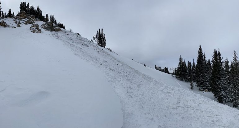
A rider-triggered slide near Berthoud Pass on Sunday, November 15. The avalanche broke above the rider but he was able to ride off of the slab.
The Central Mountains generally received 3 to 6 inches of snow with areas near Crested Butte getting as much as 10 inches. This modest load spurred a bit of avalanche activity, mostly confined to small avalanches triggered by ski patrols using explosives. A notable skier-triggered avalanche in the Sawatch Range on November 13 provided a great illustration of our developing slab-over-persistent weak layer concern.
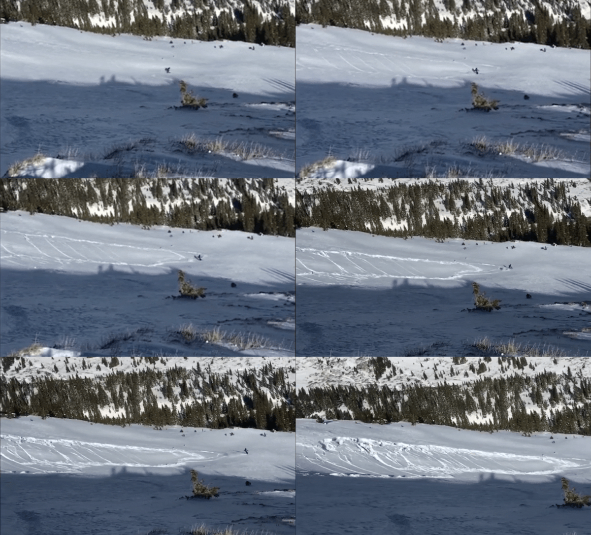
Small skier-triggered avalanche on a northeast-facing aspect in the Sawatch Range on November 13, 2020.
The Southern Mountains largely missed out on this mid-month storm, and only picked up a few inches of snowfall. They did not miss out on the wind, which redistributed the snow cover like the other mountain regions.
The last storm of the month arrived just prior to Thanksgiving Day. This one brought heavy snow to the Southern Mountains, including a nice upslope snow event in the Uncompahgre Gorge, and moderate snowfall further north. This spurred the most pronounced uptick in avalanche activity of the season with dozens of reported avalanches during and immediately following the storm. Again, all but one of these were small (less than D2 in size).
The Northern and Central Mountains picked up around 5 to 8 inches of snow in most places between November 22 and 25. We immediately saw an uptick in avalanche activity. Most of these slides were small, but a rider triggered one of the larger avalanches of the season near Berthoud Pass on November 25. On that same day, a skier triggered a small avalanche near Montezuma and took a short ride before arresting himself on the bed surface.
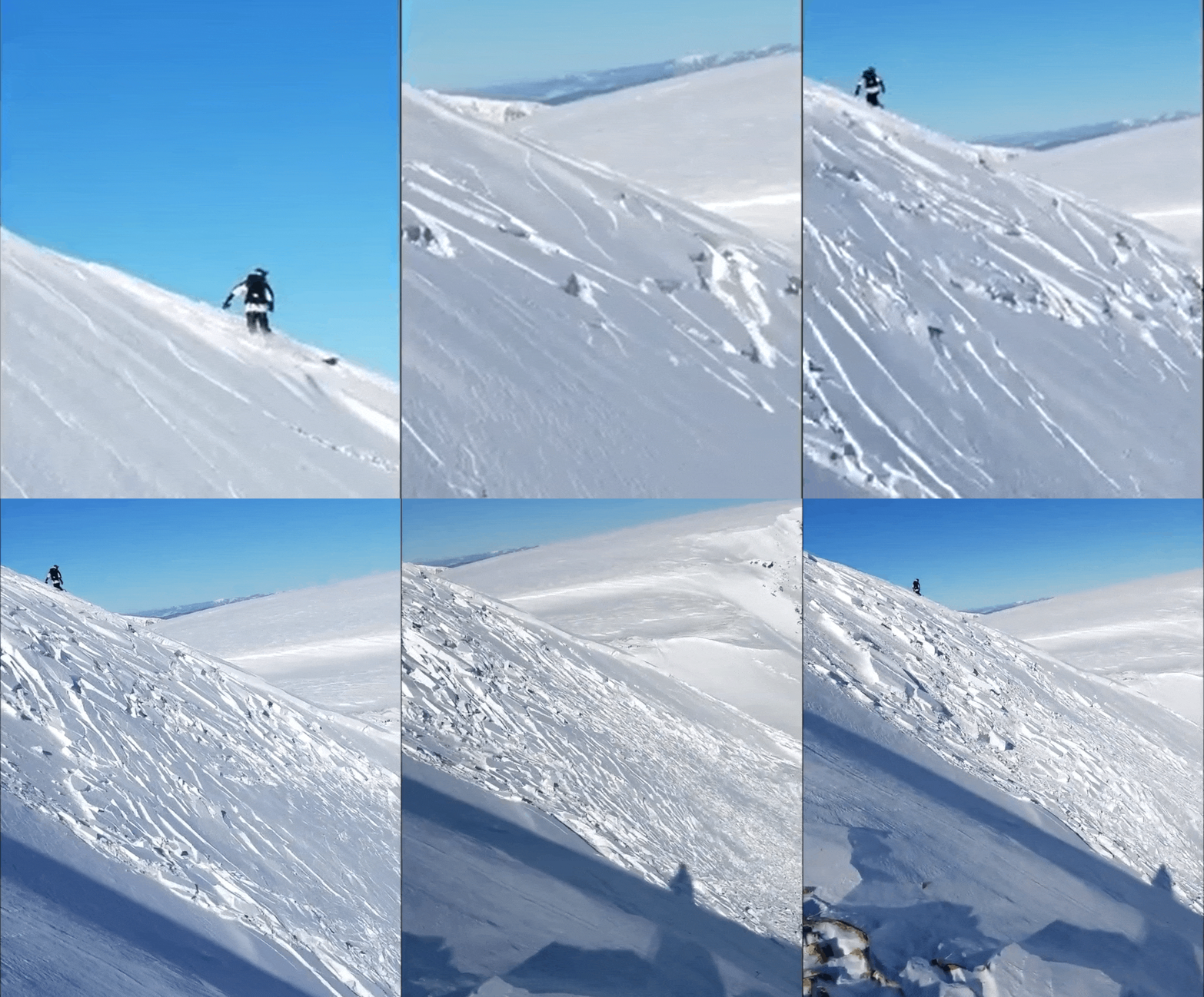
A rider-triggered avalanche on Berthoud Pass on Wednesday, November 25, 2020.
The Southern Mountains did the best from this storm arriving with warm southwest flow. The storm ended with cold air and just the right wind direction to generate more than a foot of snow on the north side of Red Mountain Pass. Avalanche activity perked up as it did elsewhere, and the day before Thanksgiving (November 25) turned out to be an active day in the Southern Mountains as well. A skier was caught and carried in a small avalanche in the Grandad Couloir near Red Mountain Pass. The skier was able to self arrest on the bed surface after getting knocked over, but lost one ski and one pole. Nearby, another skier triggered a soft slab avalanche and was able to ski out of the moving debris before being taken for a ride.
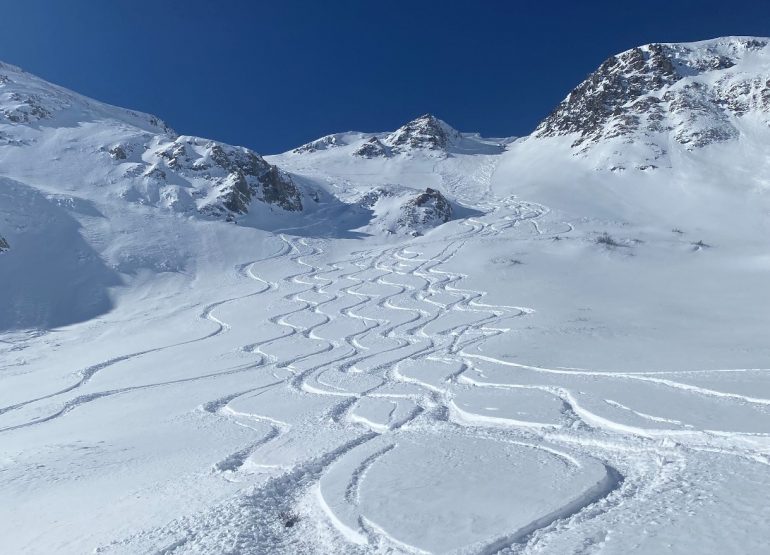
Skier-triggered avalanche on Red Mountain Pass. The skier was able to ski off the moving slab before being carried in the debris. November 25, 2020.
We ended the month with cold, clear conditions and the faceting process kicking into high gear. Small avalanches continued to trickle in through the end of the month, but there were no more reports of people being caught. Snowpack was below 30-year normal SWE, except for the Upper Rio Grande Basin, which still held ample snowpack from the nearly 5 inches of SWE it picked up in the first storm of the month.
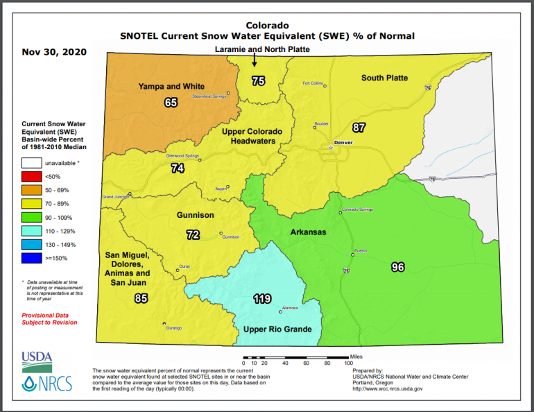
Snow water equivalent at the end of November 2020.
The forecast going into December called for above average temperatures and below average precipitation.

NOAA forecast for December 2020.
