by Mike Cooperstein
The year ended with average to above average snowfall for the month of December across Colorado. Five storms during the month pushed the Snow Water Equivalent (SWE) to over 100% of the long-term median across all of Colorado’s river basins. The Southern Mountains received the most snowfall in December with areas around Wolf Creek Pass picking up almost 90 inches of new snow in the month of December alone. The new snow and periods of wind created a stiff slab over a weak layer of depth hoar near the ground and we started to see large natural and human-triggered avalanches breaking at the ground. The CAIC recorded 547 avalanches in December. Eighty-three of those avalanches were human triggered. The CAIC recorded sixteen riders that were caught in avalanches. Tragically, one of those avalanches resulted in a fatal avalanche accident. This was the first person killed in an avalanche in Colorado during the 2019-2020 season.
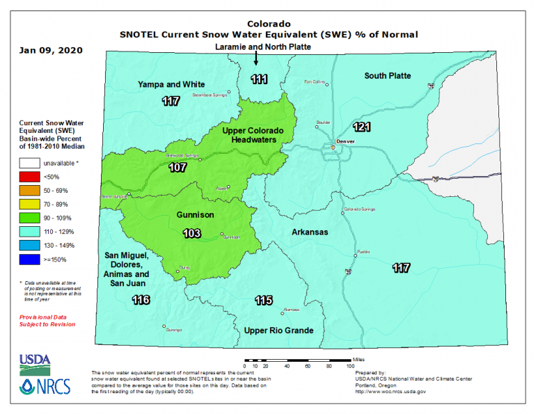
Five storms in the month of December 2019 brought us to above average snow and water for the season. This figure shows the basin wide percent of normal (percent of median from 1981 to 2010) snow water equivalent (SWE) across Colorado at the beginning of January.
December began with a few days of high-pressure, clear skies, and dry conditions. The next two weeks were a stormy period across Colorado with three storms hitting almost back to back to back from December 3 to December 16. Many areas in the Northern Mountains received 30 inches of snowfall in those 13 days. Breckenridge Ski Area received 43 inches of snowfall in the 3 days period from December 13 through December 16. Favored areas in the Central Mountains received around 2 feet of snowfall from December 3 to December 8 and then another 2 feet of snowfall from December 14 to December 16. Areas in the Southern Mountains received almost 40 inches of new snow as well in those 13 days with Wolf Creek Pass getting hit with 20 inches of snow in a 12-hour period on the night of December 16.
All of the new snow spurred a widespread avalanche cycle. Two hundred and ninety-five natural and fifty-five human triggered avalanches, large enough to kill or injure a person were reported to the CAIC in the first 16 days of the month.
| Natural Avalanches | Human-Triggered Avalanches | |
|---|---|---|
| Northern Mountains | 44 | 26 |
| Central Mountains | 191 | 16 |
| Southern Mountains | 60 | 13 |
This table shows the distribution of natural and human triggered avalanches large enough to kill or injure a person (D2 or larger) across Colorado from December 1 to December 16, 2019.
On December 8, a backcountry skier was caught, buried, and unfortunately killed by one of these large human-triggered avalanches. The accident occured on the Diamond Peaks in the Cameron Pass area of the Front Range zone. Many of these large avalanches were remotely triggered, which illustrated unstable the the threat from our Persistent Slab avalanche problem. Despite all of the new snow, the snowpack remained relatively thin across most of the state and most of these avalanches broke at the ground.
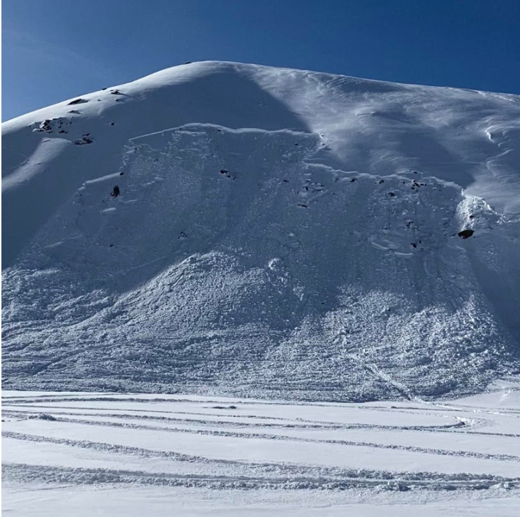
On December 1, 2019, a snowmobiler remotely triggered this avalanche in the Rollins Pass area in the Front Range zone. Observers reported cracking and collapsing and many remotely-triggered avalanches to the CAIC in the first few weeks of December.
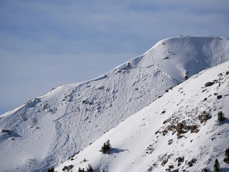
A skier triggered this avalanche on Berthoud Pass, in the Front Range zone, on December 11, 2019.
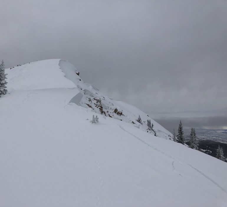
This photo shows a remotely-triggered avalanche in the Vail and Summit County zone on December 12, 2019.
From December 17 until about December 23 a period of high pressure brought dry conditions with clear skies and unseasonably warm temperatures. Temperatures rose well above freezing in many areas. This built sun crusts on southerly-facing slopes and left weak, faceted crystals on the snow surface on north and east-facing slopes. These would become the weak layers for avalanches toward the end of the month. Riders continued to trigger avalanches that broke at the ground during this prolonged dry spell.
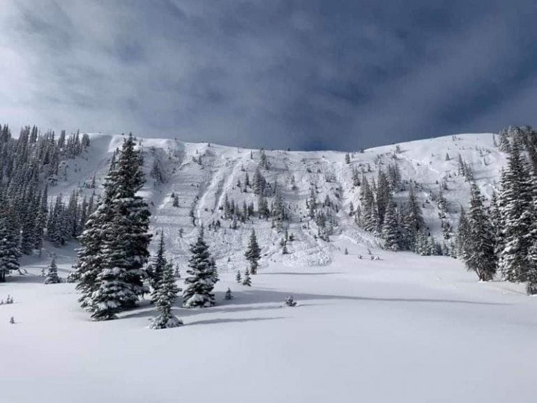
A snowmobiler remotely triggered this avalanche in the Never Summer Range, Front Range zone, on December 17, 2019. He was farther away than where this picture was taken when he triggered the avalanche.
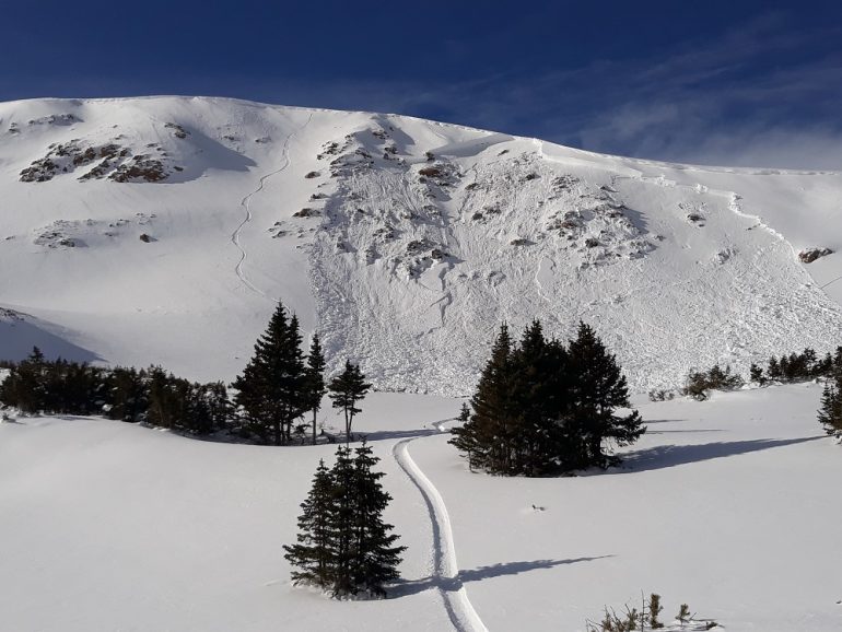
A snowboarder unintentionally triggered this large avalanche in the Loveland Pass area on the border of the Front Range and Vail and Summit County zones on December 19, 2019.
Just before Christmas another storm moved over Colorado. On December 25 and 26 areas in the Southern and Central Mountains as well as the Vail and Summit County zone accumulated 12 to 16 inches of new snow. The Steamboat and Flat Tops zone and Front Range zone picked up 3 to 8 inches of snow. This snow fell on a weak snow surface in many areas. We continued to receive reports of large natural avalanches over Christmas; however, we were seeing many fewer avalanches break at the ground and many more avalanches break at the interface between the new and old snow.
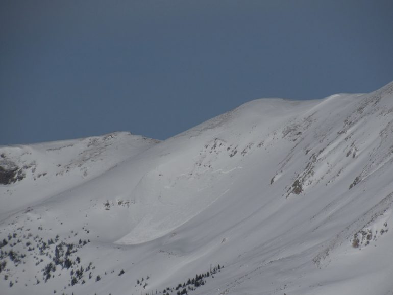
A natural avalanche in the Wemuniche Wilderness in the South San Juan zone, December 26, 2019.
The final snow storm of the decade occurred from December 27 to December 29. Snowfall favored the Southern Mountains with up to 20 inches near Wolf Creek Pass and diminishing totals as you headed north. There was still some avalanche activity breaking near the ground, but most avalanches released in storm or wind-drifted snow. Avalanches continued to break on these mid-pack weak layers for some time to come. In the deeper snowpack areas forecasters were becoming less concerned about the deeper buried weak layers. In the thin snowpack areas these basal weak layers continued to plague us every time we got big storms. We finished December the same way as we started, with clear skies and cold temperatures.
